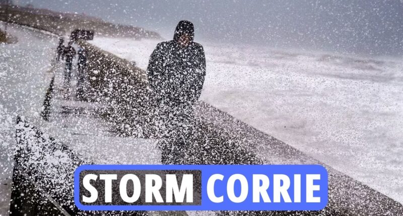
THE Met Office has issued fresh danger to life warning as Storm Corrie brings 92mph winds to the UK.
Severe gusts have left 30,000 people without power in Scotland on top of the 7,000 who were already cut off as a result of Storm Malik.
Northern Powergrid says there are an additional 4,000 people in Northumberland, Tyne and Wear and County Durham without power today.
The chaos comes just hours after Storm Malik killed two people.
Yesterday, a nine-year-old boy became Storm Malik’s second victim after he was crushed to death by a tree – after a woman, 60, was killed in Scotland.
The tree toppled down on the youngster – who was with an elderly relative who suffered a head injury – shortly after 1.10pm in Tean, Staffs, on Saturday afternoon.
Read our weather live blog for the latest news and forecasts…
-
A chaotic February
It seems February is shaping up to be a turbulent month with the elements, as a mix of wet, and windy weather with snow cause chaos.
Met forecaster James Madden said cold and snow will approach from the north during the beginning of the month, with wintry downpours potentially reaching the capital.
Long-range predictions are suggesting that snow could fall in northern regions if the freezing temperatures continue.
The risk of snow could last until at least February 11, according to forecasts, after parts of the country are soaked by rain and the white stuff.
-
January 30 to February 8 outlook
Through this period, the weather is likely to start off wetter than of late in the west, with patches of rain pushing northeastwards from the southwest on Sunday, whereas the east is likely to be settled and dry.
Cloudy and dry weather is then possible to return for most at the end of January, while it is likely to be wet and windy in the north at times, with wintry showers possible over high ground in Scotland.
Moving into February, the largely settled and cloudy weather is likely to remain for most, with some rain and wind in the far northwest at times.
Overall, temperatures are likely to be near or milder than average through this period, although some brief colder than average spells in the north are possible.
-
Flurries to hit Britain this week
Snow is coming to the UK on Friday after storms cause mayhem this weekend, new weather maps show.
The latest UK weather map from WXCharts shows snow falling on Friday (February 4) as temperatures plummet as low as -3C in Scotland.
Storm Carrie is set to move eastwards across Scotland on Sunday and push across the North Sea in the early hours of Monday.
The Met Office has issued an amber weather warning for wind across northern parts of Scotland from Sunday into Monday morning.
-
95 per cent risk of snow in Scotland
The polar freeze, set to start this week could also bring snow with it.
Maps show a high risk of snow throughout large parts of the UK on Friday morning, Express.co.uk reports.
There is forecast to be a 95 per cent risk of snow in a large region of Scotland at around 6am.
But England is unlikely to escape the onslaught, with more than a 70 per cent chance of snow in an area of North West England, as well as Wales.
-
Keep an emergency winter kit in your car
No driver plans to break down but it happens and often at the most inconvenient times.
It’s best to keep an emergency kit in the car just in case, especially if it’s dark out and temperatures have plummeted.
It’s also worth keeping de-icer in the pack so you have some ready for those frosty mornings.
Hugo said: “A torch, a first-aid kit and some emergency food and drink may also come in handy, while keeping de-icer and a decent scraper in the car will make frosty morning starts less wearisome.”
-
Odds on February to be coldest on record
Next month could be the coldest February on record, according to Ladbrokes.
The bookies now make it just a 3/1 shot for the coldest February EVER to be recorded this year, with temperatures soon set to tumble.
Odds of 2/1 says this ends up being the coldest winter since records began.
Alex Apati of Ladbrokes said: “With a big freeze set to batter all four corners of the UK, the odds suggest we’re in for some record-breaking low temperatures in the coming weeks.”
-
Snowstorm could continue until at least February 11
Met forecaster James Madden explained cold and snow will approach from the north during the beginning of the month, with wintry downpours potentially reaching the capital.
Long-range predictions are suggesting that snow could fall in northern regions if the freezing temperatures continue.
A snowstorm could continue until at least February 11, according to forecasts, after parts of the country are soaked by rain and the white stuff.
-
UK weather outlook for Monday and Tuesday
Monday will be bright with long spells of sunshine however cloud will build into northern and western areas and there is a chance of a few showers developing.
Tuesday will be dull and damp with cloudy skies and outbreaks of rain and drizzle which will be heavy at times before turning showery later.


